 CURRENT AFFAIRS

 CURRENT AFFAIRS
Description

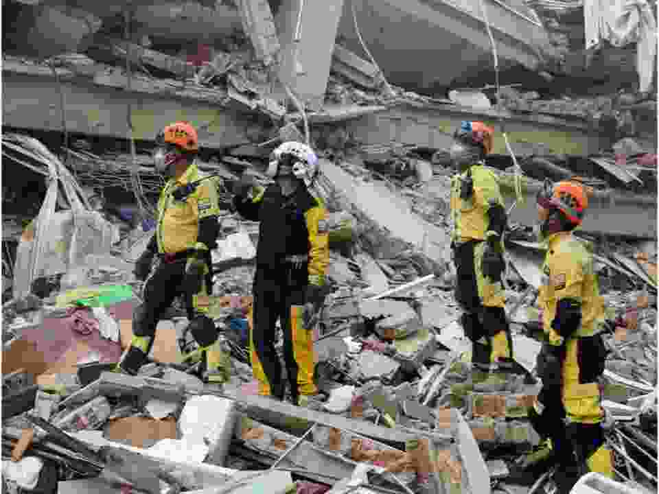
The Indian Space Research Organisation’s (ISRO) advanced Earth observation satellite, CARTOSAT-3, has provided critical high-resolution images depicting the extent of destruction caused by a 7.0-magnitude earthquake in Myanmar on March 28, 2025. The post-disaster images, captured on March 29, 2025, were meticulously analyzed and compared with pre-earthquake imagery taken on March 18, 2025, to assess damage in key affected regions, particularly Mandalay and Sagaing. This satellite-based assessment plays a crucial role in disaster management and relief operations.
Understanding CARTOSAT-3
CARTOSAT-3 is India’s third-generation agile Earth observation satellite, developed by ISRO to replace the older IRS (Indian Remote Sensing) satellite series. This satellite boasts unmatched high-resolution imaging capabilities, making it a vital asset for surveillance, cartography, disaster response, and urban planning.
Launched aboard PSLV-C47 (Polar Satellite Launch Vehicle-C47), CARTOSAT-3 is a technologically advanced satellite with improved optics, higher spatial resolution, and enhanced data transmission capabilities.
The satellite is capable of capturing images with a sub-meter spatial resolution, making it one of the most advanced Earth observation satellites ever developed by ISRO.
Key Applications Of CARTOSAT-3
CARTOSAT-3 plays a crucial role in various domains, contributing to national security, disaster management, urban planning, cartography, and environmental monitoring.
National Security & Defense Applications
The satellite is extensively used for strategic surveillance, border monitoring, and military intelligence.
Defense applications include: Monitoring enemy troop movements and border security in conflict zones. Assisting in military operations requiring detailed geospatial intelligence.
In the past, Cartosat-2 series satellites played a key role in India’s 2016 surgical strikes across the LoC (Line of Control) against terrorist camps and Myanmar-Manipur operations in 2015.
Disaster Management & Urban Planning
CARTOSAT-3’s high-resolution imagery helps in real-time monitoring and assessment of natural disasters such as: Earthquakes – Providing post-disaster imagery to assess damage, as seen in the Myanmar earthquake of 2025. Floods & Landslides – Monitoring affected regions for effective disaster response.
Urban and Rural Planning: Used for designing efficient road networks, water distribution systems, and land-use regulations. Provides precise mapping for infrastructural development projects.
Coastal Land Use Monitoring: Helps track environmental changes along coastlines. Supports efforts in coastal protection and disaster preparedness.
Cartography & Remote Sensing
The satellite’s advanced imaging capabilities make it a powerful tool for high-resolution geospatial mapping.
- Key Functions: Detecting both natural and man-made changes in geographical landscapes. Creating detailed topographical maps used in city planning and resource management.
Understanding India Earth Observation Satellite Fleet
India’s remote sensing capabilities have evolved significantly over the years, with various satellite series catering to specific applications:
The Cartosat Series (1 to 3)
Designed for high-resolution Earth observation.
Primarily used in urban and rural planning, disaster management, and defense surveillance.
The RISAT (Radar Imaging Satellite) Series
Equipped with radar-based imaging technology, allowing it to capture images even in cloudy weather conditions.
Used for surveillance, agriculture monitoring, and disaster assessment.
The Oceansat Series
Dedicated to oceanic and marine research.
Helps in monitoring ocean parameters, weather forecasting, and tracking cyclones.
INSAT & Megha-Tropiques Satellites
Focused on atmospheric and climate studies.
Used in weather monitoring, climate research, and monsoon prediction.
Welcome to Notopedia.com, your free learning platform that caters to the diverse needs of students and aspirants across a spectrum of entrance exams and educational endeavors. Whether you're preparing for highly anticipated exams like CAT 2023, NEET 2023, JEE Main, or bank job vacancies, our platform offers a wealth of resources to guide you towards success. Stay up-to-date with the latest exam dates, announcements, and results for various government recruitment exams, including SSC CGL, CHSL, NDA, and UPSC. Explore comprehensive study materials, sample papers, and exam patterns to hone your skills and boost your confidence. From important dates like CBSE Class 10 and 12 date sheets to exam-specific information like JEE Main 2023 application form date, we cover it all. Notopedia.com is your go-to source for everything from admissions and admit cards to scholarships and college information. Whether you're aiming for a career in defense, government, banking, or higher education, our free learning platform equips you with the knowledge and resources you need to excel. Join us in your educational journey and unlock a world of opportunities, guidance, and comprehensive support.
For more Updates and Information - Visit Notopedia's Bulletin Board
For Latest Sarkari Jobs - Visit Notopedia's Sarkari Jobs Section
For access to more than 20,000 Colleges - Visit Notopedia's College Section
For School Studies and Exams Preparation across 14 Boards - Visit Notopedia's School Section
For Comprehensive Preparation of Sarkari Job Exams - Visit Notopedia's Sarkari Exams Section
- ISRO
- CARTOSAT 3
- Myanmar Earthquake
- Earth Observation
- Satellite Imagery
- Disaster Management
- Remote Sensing
- Mandalay
- Sagaing
- Space Technology
The Notopedia Bulletin Board
News about the latest admissions, results, upcoming government jobs, Sarkari exams and many more.


